Top Hexagon Alternatives and Competitors
Looking to upgrade or change your solution? Take away the guesswork and stay informed with end user feedback to identify and select the solution that best matches your needs.
Hexagon's industry-leading GIS, remote sensing, photogrammetry and data management software products are used across the world to collect, process, manage and deliver location intelligence to a variety of users. Whether you’re building real-time situational awareness applications or interactive dashboards that power your daily operations, our geospatial and location intelligence platforms give you the tools to improve custom experiences.
Common Features
Mobile | High Quality Maps | Geospatial Technology | Spatial Analysis | Data Visualization GIS | Map Manipulation | Geo Coding | Map Customization | 3D Visuals | Imaging and Production | Data Integration GIS
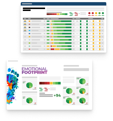
7.7
Composite
Score
+92
Emotional
Footprint
56
Reviews
Best Alternatives and Competitors to Hexagon
Compare how Hexagon stacks up to the competition in the areas that matter most to real users to short list options that will best fit your business needs.
Caliper Corporation
Maptitude GIS
8.4
Composite
Score
+95
Emotional
Footprint
46
Reviews
Reviews Say
Compared to Hexagon, Maptitude GIS is:
More Transparent
Easier to Implement
More Efficient
Better at Training
Less Caring
Less Respectful
Maptitude Geographic Information System (GIS) software gives you the tools, maps, and demographic data you need to analyze and understand how geography affects you and your business. Every day you have to contend with spreadsheets and databases filled with vast amounts of customer, employee, sales, facility, and territory data.
ESRI Ltd
ArcGIS Pro
8.2
Composite
Score
+89
Emotional
Footprint
85
Reviews
Reviews Say
Compared to Hexagon, ArcGIS Pro is:
Worse at Support
Less Transparent
Less Caring
Harder to Customize
Harder to Implement
Worse at Integrating
ArcGIS Pro is the premier desktop geographic information system (GIS) application. Crafted with user-driven innovations, it offers unparalleled tools and capabilities that support your work. Users can maintain spatial data effectively; generate stunning 2D, 3D, and 4D visualizations; and conduct advanced mapping analytics. The seamless data sharing within the ArcGIS system fosters valuable GIS solutions and insights.
Precisely
MapInfo Pro
7.7
Composite
Score
+98
Emotional
Footprint
10
Reviews
Reviews Say
Compared to Hexagon, MapInfo Pro is:
More Transparent
Easier to Use
Easier to Customize
More Innovative
Worse at Training
Worse at Support
A complete, desktop mapping solution for the geographic information system (GIS) analyst to manage, analyze, visualize, and publish location-based data
Creative Commons Corporation
QGIS
7.7
Composite
Score
+98
Emotional
Footprint
11
Reviews
Reviews Say
Compared to Hexagon, QGIS is:
More Transparent
More Efficient
Easier to Implement
Worse at Support
Harder to Use
Worse at Training
QGIS (formerly Quantum GIS) is a free, open-source desktop Geographic Information System (GIS) application that allows users to create, edit, visualize, analyze, and publish geospatial information. It supports numerous vector, raster, and database formats, running on Windows, macOS, and Linux. QGIS is widely used for cartography, spatial analysis, and environmental monitoring.
Carto
CARTO
7.6
Composite
Score
+84
Emotional
Footprint
24
Reviews
Reviews Say
Compared to Hexagon, CARTO is:
Easier to Use
Less Transparent
Worse at Support
Less Inspiring
Harder to Customize
Less Respectful
An end-to-end Spatial Analysis platform. The Spatial Analysis platform of choice for market-leading location data & visualization, built for the cloud.
Autodesk
AutoCAD Map 3D
7.5
Composite
Score
+87
Emotional
Footprint
64
Reviews
Reviews Say
Compared to Hexagon, AutoCAD Map 3D is:
Less Transparent
Worse at Support
Less Inspiring
Worse at Integrating
Less Respectful
Less Caring
Autodesk's model-based geographic information system (GIS) mapping software provides access to CAD and GIS data to support planning, design, and management. With the Map 3D toolset, you can directly access spatial data using Feature Data Objects (FDO) technology, directly edit geospatial data, and manage infrastructure systems with Enterprise Industry Models.
Mapbox
Mapbox
7.1
Composite
Score
+80
Emotional
Footprint
42
Reviews
Reviews Say
Compared to Hexagon, Mapbox is:
Less Caring
Less Transparent
Worse at Support
Less Innovative
Less Respectful
Less Inspiring
Mapbox is the location platform for developers, providing a complete suite of mapping and location services including global map data, real-time traffic, geocoding and address search, and routing and directions for navigation. Build with Mapbox APIs and SDKs across platforms, from web to mobile to embedded systems. Highly performant, customizable, and scalable, Mapbox services are trusted by companies across industries spanning logistics, business intelligence, consumer apps and beyond.
Explore
SoftwareReviews
Get Instant Access<br>to this Report
Get Instant Access
to this Report
Unlock your first report with just a business email. Register to access our entire library.
© 2026 SoftwareReviews.com. All rights reserved.