What is ArcGIS Pro?
ArcGIS Pro is the premier desktop geographic information system (GIS) application. Crafted with user-driven innovations, it offers unparalleled tools and capabilities that support your work. Users can maintain spatial data effectively; generate stunning 2D, 3D, and 4D visualizations; and conduct advanced mapping analytics. The seamless data sharing within the ArcGIS system fosters valuable GIS solutions and insights.
Company Details
Need Assistance?
We're here to help you with understanding our reports and the data inside to help you make decisions.
Get AssistanceArcGIS Pro Ratings
Real user data aggregated to summarize the product performance and customer experience.
Download the entire Product Scorecard
to access more information on ArcGIS Pro.
Product scores listed below represent current data. This may be different from data contained in reports and awards, which express data as of their publication date.
90 Likeliness to Recommend
95 Plan to Renew
74 Satisfaction of Cost Relative to Value
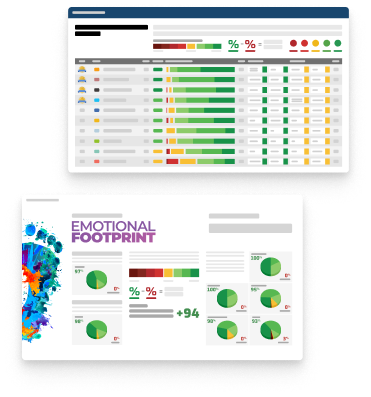
Emotional Footprint Overview
Product scores listed below represent current data. This may be different from data contained in reports and awards, which express data as of their publication date.
+89 Net Emotional Footprint
The emotional sentiment held by end users of the software based on their experience with the vendor. Responses are captured on an eight-point scale.
How much do users love ArcGIS Pro?
Pros
- Reliable
- Enables Productivity
- Respectful
- Unique Features
How to read the Emotional Footprint
The Net Emotional Footprint measures high-level user sentiment towards particular product offerings. It aggregates emotional response ratings for various dimensions of the vendor-client relationship and product effectiveness, creating a powerful indicator of overall user feeling toward the vendor and product.
While purchasing decisions shouldn't be based on emotion, it's valuable to know what kind of emotional response the vendor you're considering elicits from their users.
Footprint
Negative
Neutral
Positive
Feature Ratings
Advanced Spatial Analysis
Spatial Analysis & Geoprocessing
Mapping & Visualization
Data Interoperability
Cartographic Design & Production
Geo Coding
Mobile
Vendor Capability Ratings
Quality of Features
Business Value Created
Product Strategy and Rate of Improvement
Ease of Data Integration
Breadth of Features
Usability and Intuitiveness
Ease of Customization
Ease of Implementation
Availability and Quality of Training
Ease of IT Administration
Vendor Support
ArcGIS Pro Reviews
- Role: C-Level
- Industry: Government
- Involvement: Business Leader or Manager
Submitted Feb 2026
Somewhat costly, very powerful enterprise platform
Likeliness to Recommend
Pros
- Helps Innovate
- Continually Improving Product
- Altruistic
- Client's Interest First
Cons
- Charges for Enhancements
Please tell us why you think this review should be flagged.
Soliman G.
- Role: Industry Specific Role
- Industry: Energy
- Involvement: End User of Application
Submitted Dec 2024
Powerful Geospatial analysis tools
Likeliness to Recommend
What differentiates ArcGIS Pro from other similar products?
seamless integration with Esri’s ecosystem, and support for both 2D and 3D mapping. Its ability to handle large datasets efficiently.
What is your favorite aspect of this product?
The integration with Esri’s ecosystem and the ability to automate workflows using Python make it incredibly versatile for tackling complex geospatial challenges.
What do you dislike most about this product?
it can be resource-intensive, requiring a high-performance system to run smoothly when working with large datasets.
What recommendations would you give to someone considering this product?
investing time in training or tutorials to get familiar with ArcGIS Pro's features, especially if you're new to GIS.
Pros
- Helps Innovate
- Reliable
- Enables Productivity
- Trustworthy
Please tell us why you think this review should be flagged.

Timlok W.
- Role: Consultant
- Industry: Consulting
- Involvement: Business Leader or Manager
Submitted Nov 2024
User Friendly, but pricey
Likeliness to Recommend
What differentiates ArcGIS Pro from other similar products?
It is widely used across different organizations and easy to learn
What is your favorite aspect of this product?
User friendly interface
What do you dislike most about this product?
It is too expensive for individuals to maintain in Africa
What recommendations would you give to someone considering this product?
Get it if you have the money.
Pros
- Helps Innovate
- Continually Improving Product
- Reliable
- Performance Enhancing
Please tell us why you think this review should be flagged.

Get Instant Access<br>to this Report
Get Instant Access
to this Report
Unlock your first report with just a business email. Register to access our entire library.
© 2026 SoftwareReviews.com. All rights reserved.